Love the idea of stepping out your door and hitting a trail before work or after dinner? If easy access to hiking, biking, and winter recreation is your top priority, where you choose to live in the Bozeman area matters. Harvest Creek puts you close to foothill and valley paths with reasonable drives to the region’s bigger mountain systems.
In this guide, you’ll learn why Harvest Creek is a smart fit for trail-first living, what trail networks are within easy reach, and how to shop for a home that truly delivers the access you want. You’ll also get a buyer checklist to confirm trail proximity, understand seasonal access, and avoid common surprises. Let’s dive in.
Why Harvest Creek works for trail lovers
Harvest Creek is a residential subdivision in Gallatin County near the east and southeast approaches to the greater Bozeman area along the Gallatin Valley corridor. You get a neighborhood feel and an efficient commute to Bozeman services while staying close to open foothill and valley trail networks. Buyers drawn to Harvest Creek often value quick drives to trailheads and a balanced location for work, school, and daily errands.
The practical benefit is simple: you’re close to the Bridger foothills and valley trailheads used by hikers, runners, and mountain bikers. Depending on traffic, road conditions, and your exact address, you can reach the Bridger Range and north Bozeman trailheads as well as Hyalite Canyon in a short, manageable drive. You also have access to flat river-corridor trails along the East Gallatin and nearby valley pathways for easy walks, stroller-friendly runs, and fat-biking when conditions allow.
Local trails around Bozeman cross a patchwork of city and county open space, private easements, and national forest lands. Rules and maintenance vary by manager, including the City of Bozeman, Gallatin County, the U.S. Forest Service, Montana Fish, Wildlife & Parks, and local land trusts and trail coalitions. Always check posted signage, current conditions, and permitted uses before you go.
Trails within easy reach
Bridger Foothills and ridge routes
If you want fast access to ridge views and classic Bozeman singletrack, the Bridger foothills deliver. Popular options include the M Trail, ridge routes, and connector trails used by hikers and mountain bikers. These close-to-town trails are go-to choices for after-work laps with varied terrain and quick elevation.
Uses typically include hiking, biking, trail running, and dogs where allowed. Expect mixed traffic on busy evenings and weekends. Many foothill routes are usable most of the year, shifting to snowshoeing or fat-biking in winter when snowpack and tread allow.
Drinking Horse area and Four Corners foothills
Closer-in foothill terrain offers short to moderate loops, quick climbs, and beginner-friendly options alongside more advanced lines. These trails are popular with Harvest Creek neighbors looking for a faster outing with minimal driving.
Expect multi-use etiquette. Some trailheads are small, and parking can fill early on weekends. Plan for an early start during peak seasons and have a backup area in mind.
Hyalite Canyon
Hyalite Canyon in the Custer Gallatin National Forest is the region’s primary alpine playground. Highlights include Hyalite Reservoir, Palisade Falls, Windy Pass, and numerous singletrack options that deliver higher-elevation terrain you won’t find in the lower foothills.
It’s a classic day-trip area, usually about 20-40 minutes from valley neighborhoods depending on starting point, road conditions, and season. Uses include hiking, mountain biking on designated routes, climbing, snowshoeing, cross-country skiing, and backcountry travel where avalanche risk can be present. Hyalite is managed by the U.S. Forest Service, so follow posted rules and check seasonal updates before heading out.
East Gallatin River and valley trails
For mellow outings, the East Gallatin River corridor and valley pathways offer flat routes for walking, running, and biking. In some segments, winter grooming may support cross-country skiing when conditions permit. These paths connect to neighborhood systems, which means you can often ride from home instead of loading the car.
Gallatin River access
Riverside access points along the Gallatin complement mountain adventures with low-elevation options that can be enjoyable much of the year. You’ll find fishing access and short pathways for relaxed walks near the water.
How long will it take from Harvest Creek?
Drive times always depend on your exact address, traffic, and season. As a general guide:
- Bridger foothills and north Bozeman trailheads: roughly 10-25 minutes for many homes
- Hyalite Canyon: commonly 20-40 minutes for a day-trip
- East Gallatin and valley pathways: often bikeable or a very short drive from subdivisions
Winter road conditions can add time, and trailhead parking fills early on weekends and holidays. Give yourself margin during peak seasons.
What to expect on the trails
- Parking and peak hours: Popular access points can fill quickly on weekends and holidays. Some neighborhood-adjacent trails rely on small pullouts or on-street parking. Respect posted signage and neighborhood rules.
- Multi-use etiquette: Many Bozeman-area trails host hikers, runners, bikes, and sometimes horses. Know right-of-way norms and yield with care to reduce conflicts.
- Seasonal closures: Spring closures may appear to protect wet soils. Higher elevations can hold snow well into late spring. Check conditions before you go.
- Winter recreation: Hyalite becomes the primary winter destination for nordic and backcountry users. Foothill routes near Harvest Creek often shift to snowshoeing or fat-biking when conditions allow. Plowed access and maintenance vary by agency.
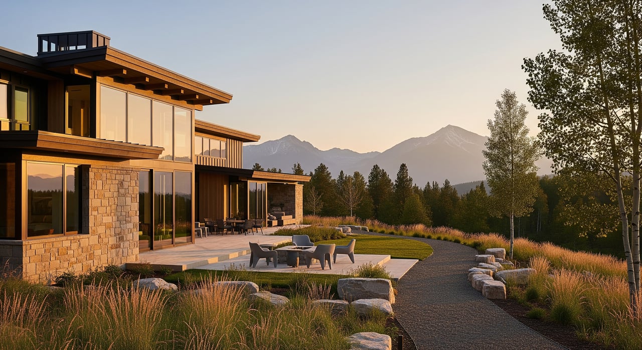
Homes near the trails: styles and features
Around Harvest Creek and nearby developments, you’ll mostly find single-family detached homes, often ranch-style or two-story, with designs that work for active lifestyles. Many newer homes lean mountain-contemporary or craftsman in feel and include practical touches like mudrooms, gear storage, and garages that make room for bikes and skis.
Townhomes and duplexes appear in some neighboring projects if you want lower-maintenance living. Lot sizes vary widely, from smaller lots in closer-in subdivisions to larger parcels farther out. Newer master-planned communities often integrate internal paths or connect to public networks through easements, and some include private amenity trails or neighborhood trailheads.
Because demand is strong for homes with short trail access, properties closest to trailheads or with direct connections often command a premium over similar homes farther out. Buyers sometimes trade a bit of square footage or lot size to get the proximity they want. If you prioritize space, you may find better value a bit farther from the most popular access points, with a longer drive to certain trailheads.
HOA, easements, and due diligence
Many newer subdivisions have HOAs that govern exterior standards and maintain private or amenity trails. Review CC&Rs for rules about trail use, maintenance obligations, and limits on commercial activity such as short-term rentals.
Some properties back to public or private trail easements. A yard that appears to border open space could be adjacent to private land or a public access corridor. Confirm exact easement locations and widths with county plats, recorded documents, and a current survey. If a path is visible from the property, verify whether it is public, seasonal, or gated before you finalize an offer.
Buyer checklist for trail-first living
Use this list to make sure the home you choose delivers the access you expect.
- Confirm actual access: Check county plat records, property surveys, and recorded easements. Do not rely on appearances or verbal descriptions.
- Validate permitted uses: If you plan to bike specific routes, verify that bikes are allowed. Some trails are hiking-only or close seasonally.
- Ask about parking impacts: If the home sits near a popular trailhead, ask the seller and neighbors about weekend overflow and seasonal patterns.
- Plan for gear storage: Look for a garage layout and mudroom that fit your bikes, skis, and seasonal gear.
- Check winter access: Review HOA and county plowing schedules. Understand how snow removal affects your route to favored trailheads.
- Know the land managers: Trails may cross city, county, private, or national forest lands, each with different rules, hours, and maintenance.
- Consider wildlife and stewardship: Expect elk, deer, and occasional black bears in open spaces. Secure garbage, follow leash rules, and be prepared for mosquitoes near late-summer water.
- Keep a conditions routine: Before big outings, check current updates through local trail groups, parks departments, or the U.S. Forest Service.
How a local expert helps you buy with confidence
When trail access is a top priority, you want precise due diligence. I help you verify easements, interpret CC&Rs, and coordinate with title and survey to confirm what is public, private, or seasonal. I also flag trade-offs around parking, winter maintenance, and daily drive times so your decision fits how you actually live.
You’ll get data-backed pricing guidance, a clear plan for competitive homes near high-demand trailheads, and connections to local resources and vendors. If you’re relocating, I can map a tour that pairs listings with nearby trail options so you can experience the terrain you care about most.
Ready to find your fit near Bozeman’s trails? Let’s talk about your goals and the best pockets of Harvest Creek for your routine. Reach out to Bronson Neff to get started.
FAQs
How close is Harvest Creek to Bozeman’s major trailheads?
- Many Bridger foothills trailheads are roughly 10-25 minutes away, and Hyalite Canyon is commonly a 20-40 minute drive depending on address, traffic, and season.
Which nearby trails typically allow mountain bikes?
- Many foothill and valley routes permit bikes, while some trails are hiking-only or have spring closures; always check posted rules and current agency or trail group updates.
What housing types near Harvest Creek work well for outdoor gear?
- Single-family homes with mudrooms and garage storage are common, and some townhomes or duplexes provide lower-maintenance options with trail access nearby.
How do I confirm that a path behind a home is public?
- Review county plats, recorded easements, and a current survey, and contact parks or local trail coalitions to confirm whether access is public, private, or seasonal.
What should I expect for winter trail access and safety?
- Foothill routes near Harvest Creek often support snowshoeing or fat-biking when conditions allow, while Hyalite offers nordic and backcountry options with potential avalanche risk in certain zones.
